At a glance
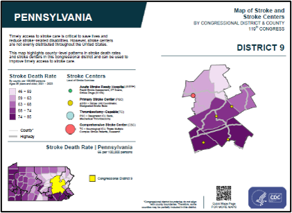
Quick Maps are ready-made, high-quality maps that can easily be downloaded and incorporated into digital and print materials.
National maps
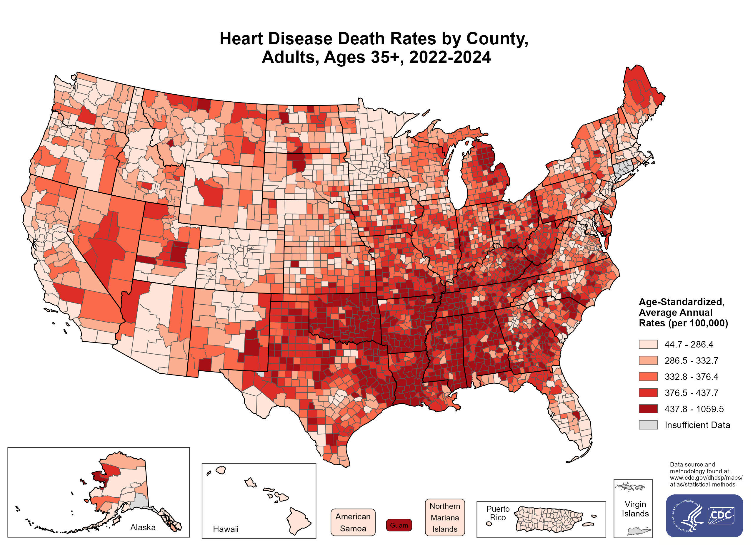
National maps display county-level patterns of heart disease and stroke, cardiac rehabilitation, and community characteristics.
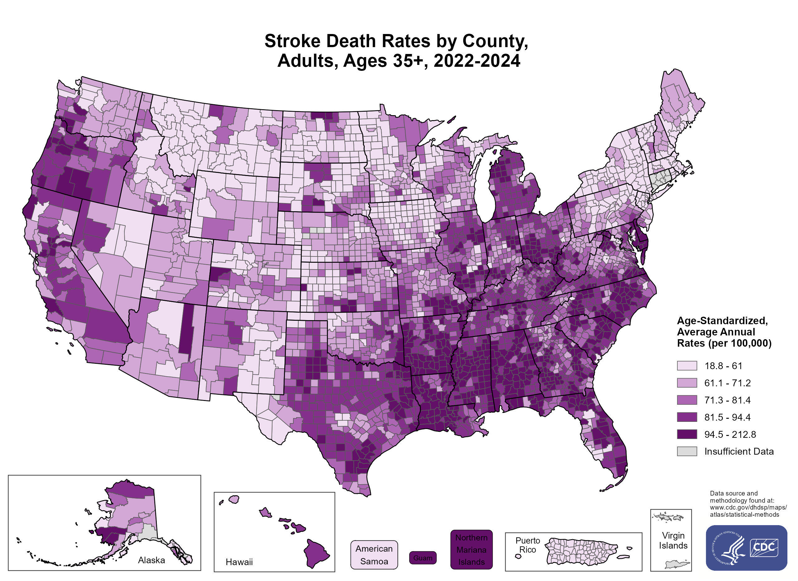
View and download maps on heart disease and stroke showing national data.
View and download maps on heart disease and stroke showing national data.
Download national maps of county-level patterns of social determinants of health.