Key points
Data sources
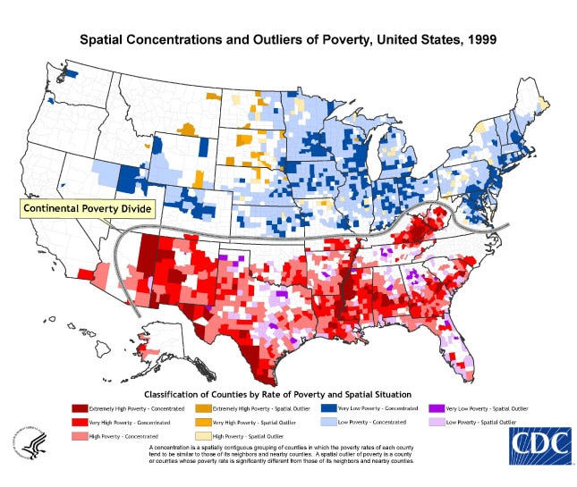
The purpose of this map is to better depict the spatial concentration of poverty, at the county-level, for the United States.
ArcGIS
2000 SF-3 Long Form Census Data.
Local Moran’s I combined with statistical categorization of poverty.
James B. Holt, Team Leader, Analytic Methods, CDC
(770) 488-5510
jgh4@cdc.gov
Spatial Concentrations and Outliers of Poverty, United States, 1999 James B. Holt. Accessed from the Centers for Disease Control and Prevention's Chronic Disease Map Gallery.

