Key points
Data sources
ArcGIS 9.3
Tennessee Department of Health.
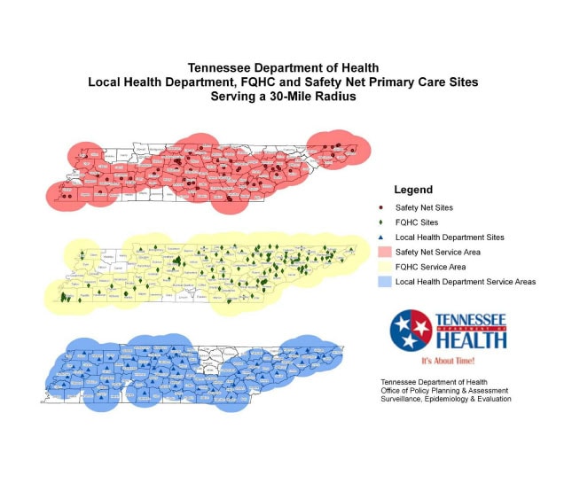
Each facility location was geo-coded and mapped. A 30-mile radius area was generated around each facility.
Yinmei Li, Director, Surveillance, Epidemiology & Evaluation, Tennessee Department of Health
(615) 741-8190
yinmei.li@tn.gov
Local Health Department, FQHC and Safety Net Primary Care Sites, Tennessee Department of Health, Jan. 2010 Croom, Fred; Li, Yinmei. Tennessee Department of Health Office of Policy, Planning and Assessment Surveillance, Epidemiology and Evaluation, [TODAY’S DATE]. Accessed from the Centers for Disease Control and Prevention's Chronic Disease Map Gallery.

