Key points
Data sources
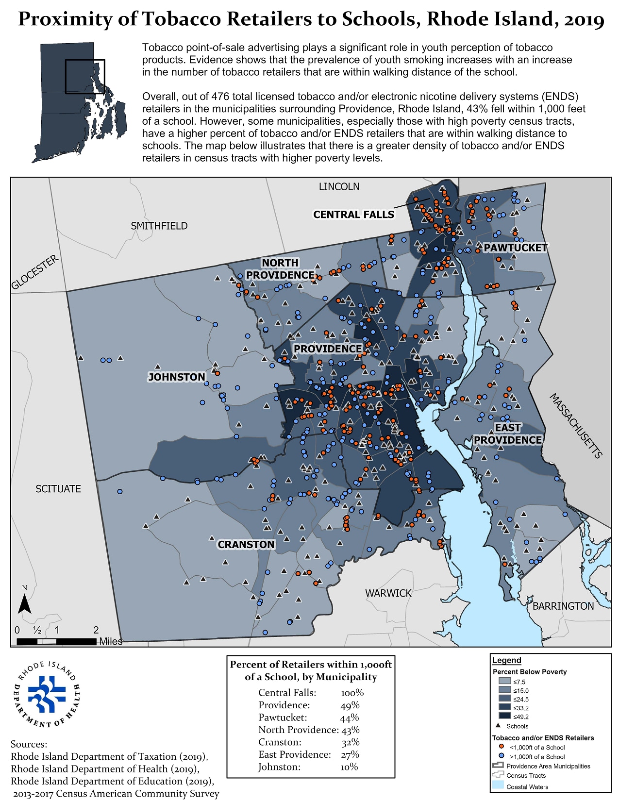
Providence-area municipalities with the highest proportion of adults below poverty (Central Falls, Providence, and Pawtucket) also have the highest proportion of tobacco and/or ENDS retailers that are within walking distance from a school.
ArcGIS Pro
Rhode Island Department of Taxation (traditional tobacco licenses), Rhode Island Department of Health (Electronic Nicotine Delivery Systems licenses), Rhode Island Department of Education (school locations), Census American Community Survey (sociodemographic layers).
Prevalence estimates for sociodemographic factors, point prevalence by polygon, buffering, spatial joins.
This map will be used primarily to facilitate stronger partnerships with at-risk/high disparity municipalities ultimately to develop policy aimed to: reduce tobacco advertising especially in stores within walking distance of a school, restrict the number of tobacco and/or ENDS licenses to retailers within walking distances to schools, and improve point-of-sale environments in stores (e.g. ensuring that products are behind the counter and not at eye-level for youth).
Morgan Orr, Program Evaluator/Epidemiologist
Rhode Island Department of Health (RIDOH)
morgan.orr@health.ri.gov
401-222-1250
Morgan Orr, Rhode Island Department of Health. Accessed from the Centers for Disease Control and Prevention's Chronic Disease Map Gallery.

