Key points
Data sources
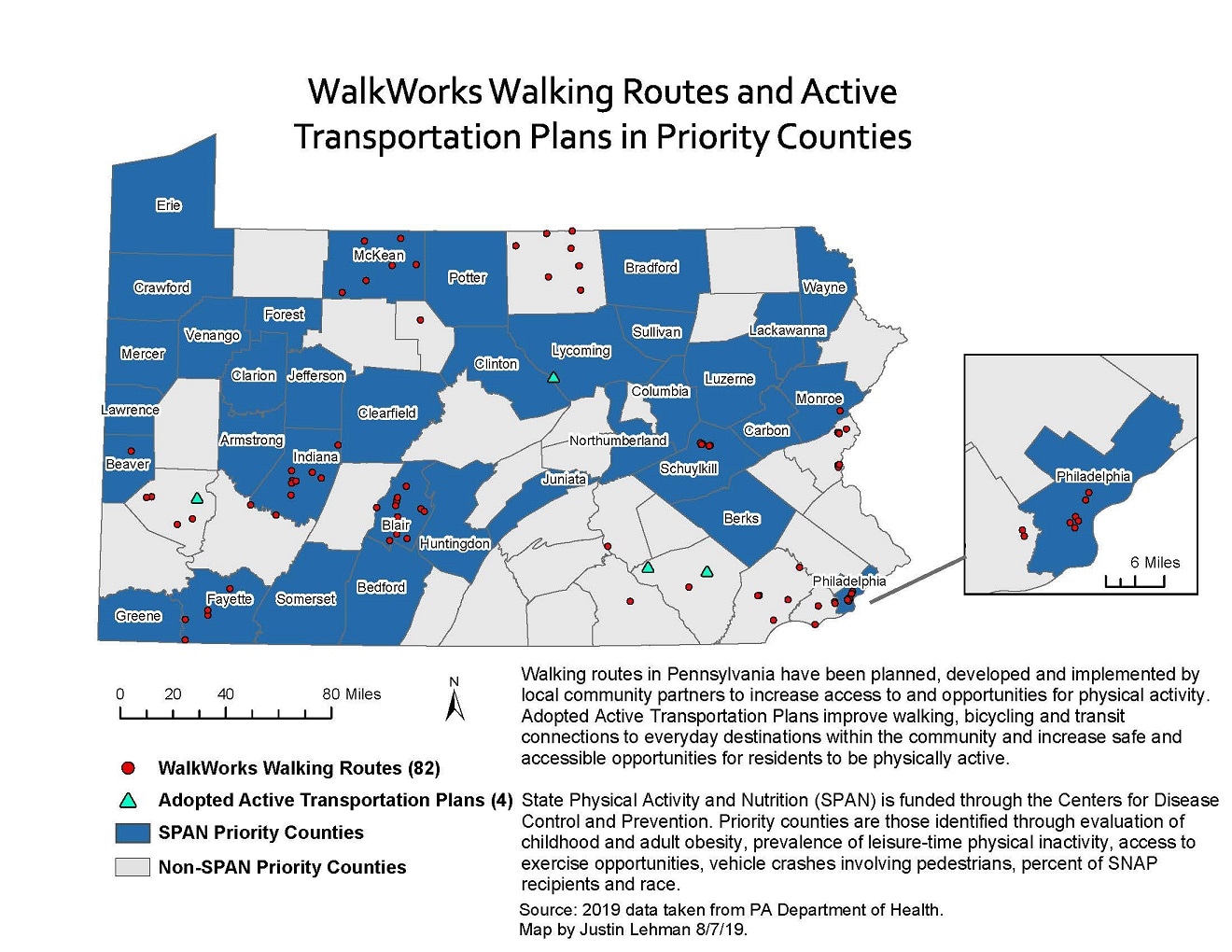
This map shows 82 of the WalkWorks walking routes, of which, 49 (60%), were in SPAN priority counties. One in four adopted active transportation plans were in priority counties.
ArcGIS
Pennsylvania WalkWorks Walking Routes, 2019; Pennsylvania Adopted Active Transportation Plans, 2019; SPAN and Non-SPAN Priority Counties, State Physical Activity and Nutrition (SPAN) Grant, 2018
State Physical Activity and Nutrition (SPAN) grant priority counties were identified through evaluation of childhood and adult obesity, prevalence of leisure-time physical inactivity, access to exercise opportunities, vehicle crashes involving pedestrians, percent of SNAP recipients and race. WalkWorks walking routes and adopted active transportation plan data was pulled from the WalkWorks program in 2019.
Justin Lehman, Pennsylvania Department of Health
Justin Lehman, Pennsylvania Department of Health. Accessed from the Centers for Disease Control and Prevention's Chronic Disease Map Gallery.

