Key points
Data sources
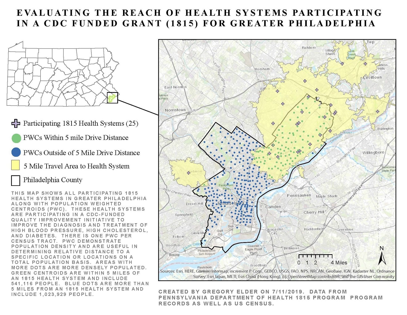
There are 12 participating 1815 health systems within the city limits of Philadelphia, and an additional 13 health systems with proximity to the city. The entire population of northeast Philadelphia and much of the population of north Philadelphia are within a 5-mile drive of a participating 1815 health system.
Populations in west Philadelphia, southwest Philadelphia, and south Philadelphia have virtually no access to 1815 participating health systems.
ArcGIS
Data from Pennsylvania Department of Health 1815 program records from 2019 as well as US Census data from 2017.
US Census data from 2017 was used to identify total population counts and create population weighted centroids per census tract to ascertain where and how many people lived in the analysis area. Network based service area analysis was performed by analyzing population geography, health system locations, and road system networks to determine distance of population from the health systems. A spatial selection of a 5-mile service area was performed to determine how many people in the city of Philadelphia were within a defined service area from a participating health system.
Gregory Elder, Pennsylvania Department of Health
Gregory Elder, Pennsylvania Department of Health. Accessed from the Centers for Disease Control and Prevention's Chronic Disease Map Gallery.

