Key points
Map

Data sources
Major Findings
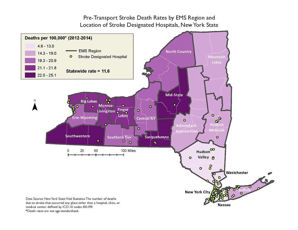
This map demonstrates pretransport stroke mortality variations across the EMS regions of the state. The concentrations of EMS regions with the highest pretransport stroke death rates are located primarily in the central and western regions of the state, while the lowest pretransport stroke death rates are predominantly located in the EMS regions closer to New York City and the eastern half of the state. The crude pretransport stroke death rates range from 4.6 to 25.1 per 100,000 residents among all the regions in the state, while the average crude pretransport stroke death rate was 11.6 per 100,000 deaths during 2012–2014.
How the map will be used, or has been used
This map will aid EMS and hospital partners in planning and decision making to optimize regional collaboration of prehospital stroke care and assist stroke designated hospitals to inform community education efforts.
ArcGIS 10.1
New York State Vital Statistics, 2012–2014.
Pretransport stroke death rates were calculated based on the number of deaths due to cerebrovascular disease that occurred anyplace other than a hospital, clinic, or medical center per 100,000 population. The ICD-10 codes used for cerebrovascular disease are I60–I69, and the crude rates are presented by quintile of EMS regions for 2012–2014 (3 years combined).
Kathleen Wales, Program Research Specialist 3, New York State Department of Health
518-473- 0673
kathleen.wales@health.ny.gov
Kathleen Wales, New York State Department of Health. Accessed from the Centers for Disease Control and Prevention's Chronic Disease Map Gallery.
