Key points
Data sources
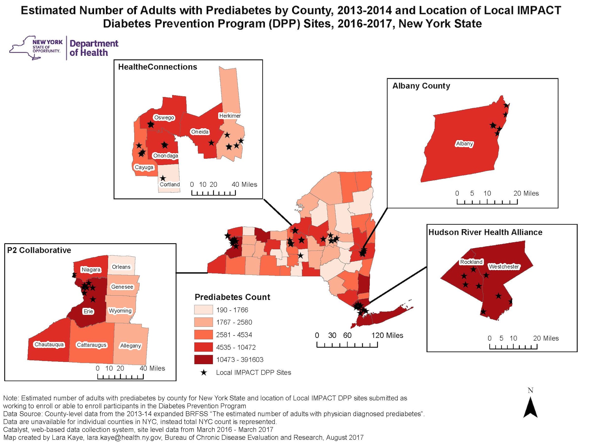
This map depicts the estimated number of adults who have prediabetes in New York State by county with insets of the four Local Initiative for Multi-sector Public Health Action (IMPACT) regions. In each region, stars indicate the location of sites working towards enrollment, or enrolling participants in a Diabetes Prevention Program (DPP).
ArcGIS 10.5.1
County-level data from the 2013–2014 expanded BRFSS and site level data from Catalyst on-line reporting system, March 2016–March 2017.
The outcome mapped is the estimated number of adults with prediabetes by quintiles of county. The five counties that make up NYC are represented by one count. The locations of sites were generated by geocoding addresses of Local IMPACT DPP sites. These sites are working to enroll, or capable of enrolling, participants in the program.
Lara Kaye, Evaluation Specialist III, NYS Department of Health, Bureau of Chronic Disease Evaluation and Research
518-473-4469
lara.kaye@health.ny.gov
Kaye, L. "Adults with Prediabetes by County and Local IMPACT DPP Sites [map]. September 2017. Bureau of Chronic Disease Evaluation and Research, New York State Department of Health. Accessed from the Centers for Disease Control and Prevention's Chronic Disease Map Gallery.

