Key points
Map

Data sources
Major Findings
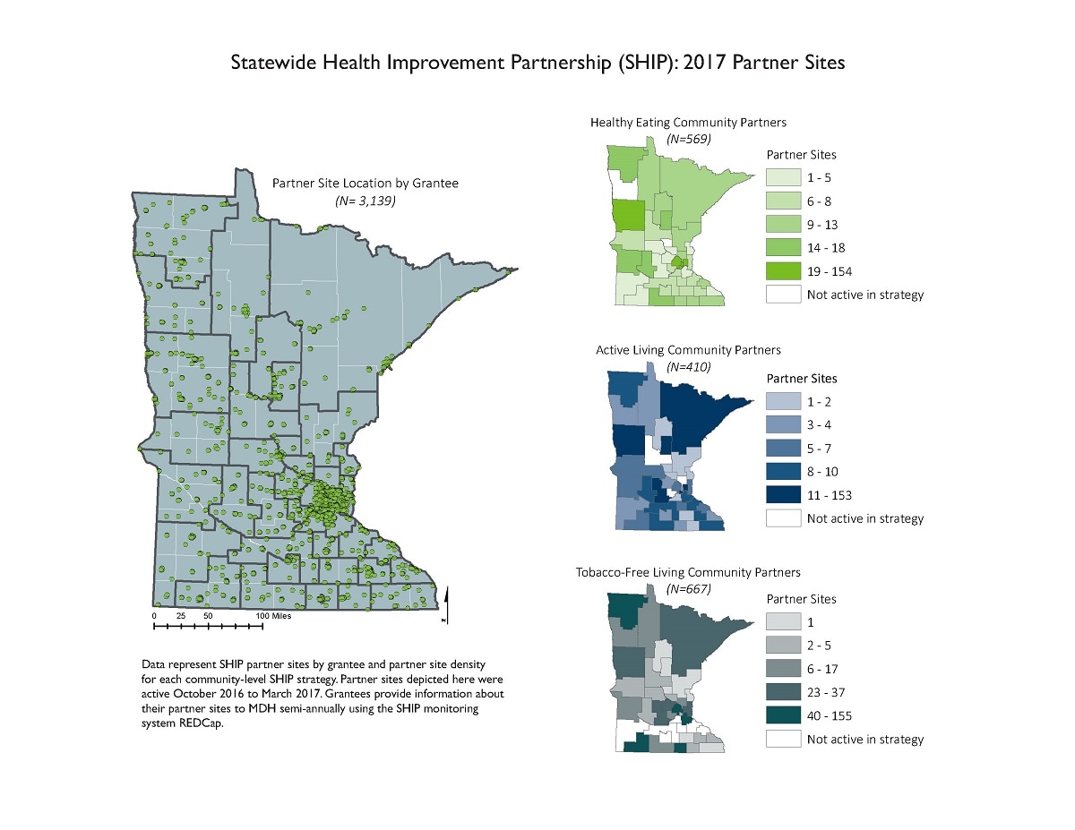
This map represents the locations of SHIP's 3,000 partner sites that are working across the state to improve local access to healthy foods, increase opportunities for physical activity, and create tobacco-free environments. Partner locations are often clustered in cities and small towns, but in rural areas these partners often serve wide geographic areas.
How the map will be used, or has been used
This map series has been used to communicate the reach of SHIP work and to inform local and state level planning and technical assistance provision. Other maps in the series have been shared with local public health leaders, legislators, and other local decision makers to demonstrate the breadth of SHIP's work in communities across the state.
ArcGIS 10.5
Data represent SHIP partner sites by grantee and partner site density for each community-level SHIP strategy. Partner sites depicted here were active October 2016 to March 2017.
Local public health agencies provide data on their SHIP partners to the Minnesota Department of Health annually using a secure online monitoring platform. Data include partner location, activities, and policy, systems, and environmental changes that have been made over the reporting period. Partner locations were mapped as point locations for the state of Minnesota, and they are shown over grantee region boundaries. Partner density by grantee region was calculated by partner strategy for community-level SHIP strategies (Healthy Eating, Active Living, and Tobacco-Free Living).
Cate Bosserman, Research Scientist, Minnesota Department of Health Office of Statewide Health Improvement Initiatives
651-201-5428
cate.bosserman@state.mn.us
Cate Bosserman, Minnesota Department of Health. Accessed from the Centers for Disease Control and Prevention's Chronic Disease Map Gallery.
