Key points
Map details
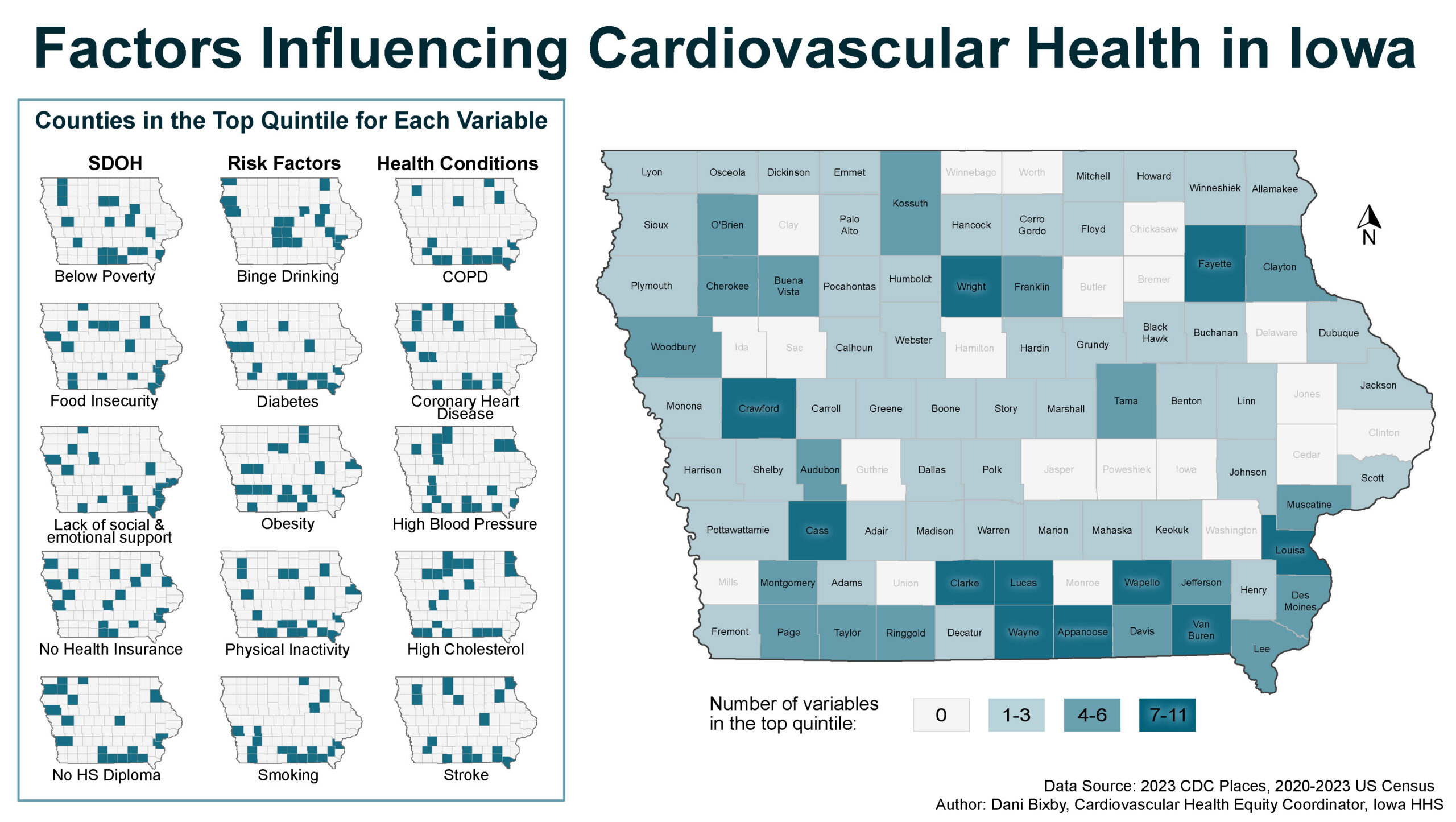
County-level maps of Iowa display counties in the top quintile for 15 separate measures of cardiovascular risk factors, social determinants of health, and cardiovascular health outcomes. One large map of Iowa displays, for each county, the number of variables that are in the top quintile. Eleven counties are in the category with the highest number of overlapping categories with 7 to 11 variables; 18 counties are in the category with the second highest number of overlapping categories with 4 to 6 variables; 49 counties are in the category with the third highest number of overlapping categories with 1to 3 variables; and 21 counties do not have any of the categories in the highest quintile and are not included in overlapping categories.
ESRI ArcGIS, Affinity Designer
BRFSS/PLACES; U.S. Census Bureau
Counties in Iowa were categorized by quintile for 15 separate variables (social determinants of health, behavioral risk factors, and cardiovascular conditions and diseases).Fifteen small maps were created displaying the counties in the top quintile for each variable. Counties were then categorized and mapped based upon the number of variables for which they were in the top quintile (Low = 1 to 3 variables, Medium = 4 to 6 variables, and High = 7 to 11 variables).
The map will be used by the Iowa Cardiovascular Collaborative group to discuss and identify priority areas around cardiovascular health needs in the state.
Dani Bixby, Cardiovascular Health Equity Coordinator
Iowa Department of Health and Human Services
dani.bixby@hhs.iowa.gov
Bixby, Dani, Iowa Department of Health and Human Services. Accessed from the Centers for Disease Control and Prevention’s Chronic Disease GIS Map Gallery.