Key points
Map

Data sources
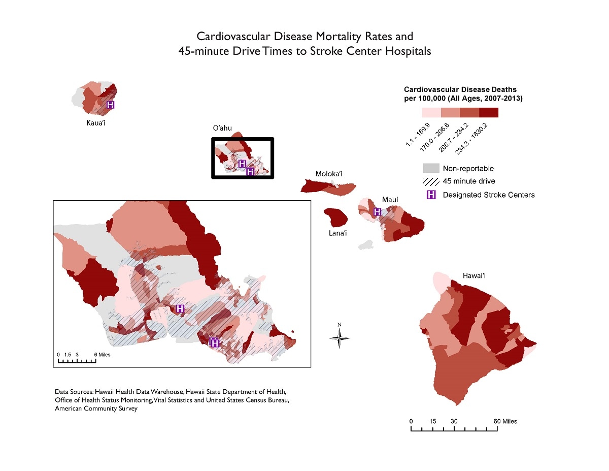
Several census tracts in the highest quartile of cardiovascular disease mortality rates are located on islands (Hawaii [Big Island], Moloka‘i, and Lana‘i) with no access to a stroke center. Even on O‘ahu, with three designated stroke centers, there are several census tracts with high mortality rates that fall outside the 45-minute drive time range.
This map will be useful to identify areas that are lacking resources to properly treat persons who have had a stroke.
ArcGIS 10.5
Hawaii Health Data Warehouse of the Hawaii State Department of Health Office of Health Status Monitoring and Vital Statistics and the U.S. Census Bureau’s American Community Survey
Cardiovascular disease deaths were classified into quartiles. ArcGIS Network Analyst was used to determine a 45-minute drive time to a stroke center and was symbolized with cross-hatching.
Alexis Barnett-Sherrill, Health System Specialist, Hawaii State Department of Health
808-692-7475
alexis.barnett-sherrill@doh.hawaii.gov
Alexis Barnett-Sherrill, Hawaii State Department of Health. Accessed from the Centers for Disease Control and Prevention's Chronic Disease Map Gallery.
