Key points
Data sources
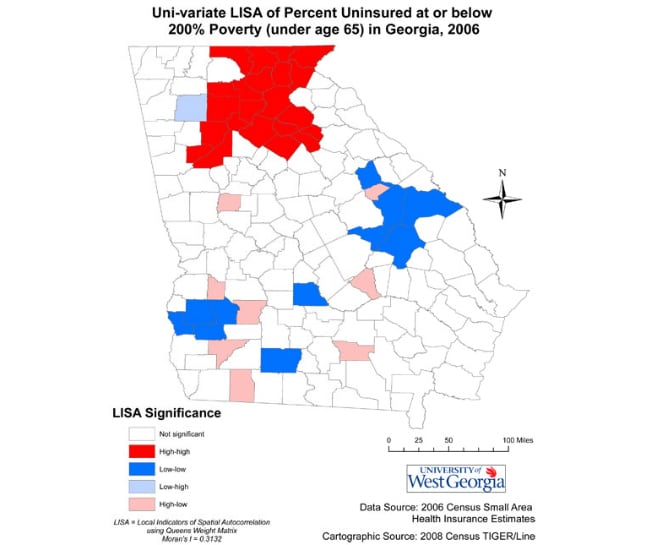
Findings here inform policy makers of areas with high levels of non-insured amongst lower income populations, clarifying descriptive statistics by documenting clusters of similar non-insurance rates.
Arc GIS 9.3, Geoda 0.95i
U.S. Census Bureau Small Area Health Insurance Estimates (SAHIE), 2006.
Uni-variate Local Indicators of Spatial Autocorrelation (LISA) with a Queens Weight matrix; counties with statistically significant correlations mapped.
Todd Matthews, Assistant Dean, College of Social Sciences and Assistant Professor, Department of Sociology, University of West Georgia
(678) 839-6325
tmatthew@westga.edu
Spatial Variations in Health Insurance Coverage for Lower Income Population in Georgia Counties, 2006 Matthews, Todd, University of West Georgia; Brace, Andrea, University of Georgia. Accessed from the Centers for Disease Control and Prevention's Chronic Disease Map Gallery.

