Key points
Data sources
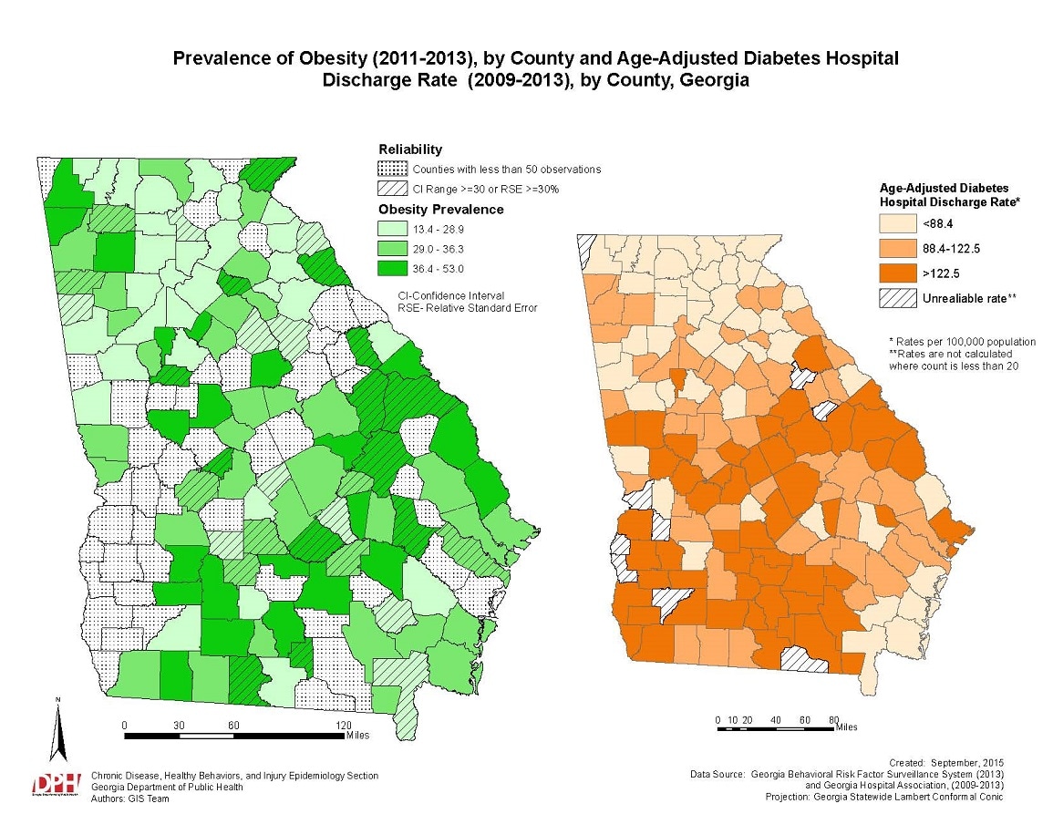
Clusters of counties with a high prevalence of obesity were seen along the eastern coast as well as the northwestern region of the state. The smaller map displays the age-adjusted hospital discharge rate per county in Georgia. 54 of the 151 counties had diabetes discharge rates higher than 122.5 per 100,000 people. Regions with high diabetes morbidity include the eastern coastal region, southern region, central region, and the northwestern region. The two maps in conjunction show where high obesity prevalence overlap with high diabetes discharges.
Arc Map 10.2, SAS-Callable SUDAAN v911.0.1
Georgia Hospital Discharge Data (2009-2013), Georgia Behavioral Risk Factor Surveillance System (BRFSS) (2011-2013).
The Georgia BRFSS was analyzed using SAS-callable SUDAAN version 11.0.1. The years 2011 through 2013 were combined. Obesity prevalence was calculated at the county level. Data for counties with less than 50 observations were suppressed. In addition, counties with a confidence interval range larger than 29 or relative standard error larger than 29% are depicted with a hash symbol. Diabetes hospital discharge data was combined for years 2009-2013. Hospital discharge rates were age-adjusted and calculated at the county level. Rates are per 100,000 population. Arc Map version 10.2 was used to display obesity prevalence and diabetes age-adjusted rates.
Victoria Davis, Epidemiologist, GA Department of Public Health
404-463-8917
victoria.davis@dph.ga.gov
Davis, D,; Ido, M.; Kumar, G.; Bayakly, R. “Prevalence of Obesity (2011-2013) and Age-Adjusted Diabetes Hospital Discharge Rate (2009-2013), by County, Georgia. ” [map]. September 2015. Georgia Department of Public Health. Accessed from the Centers for Disease Control and Prevention's Chronic Disease Map Gallery.

