Key points
Data sources
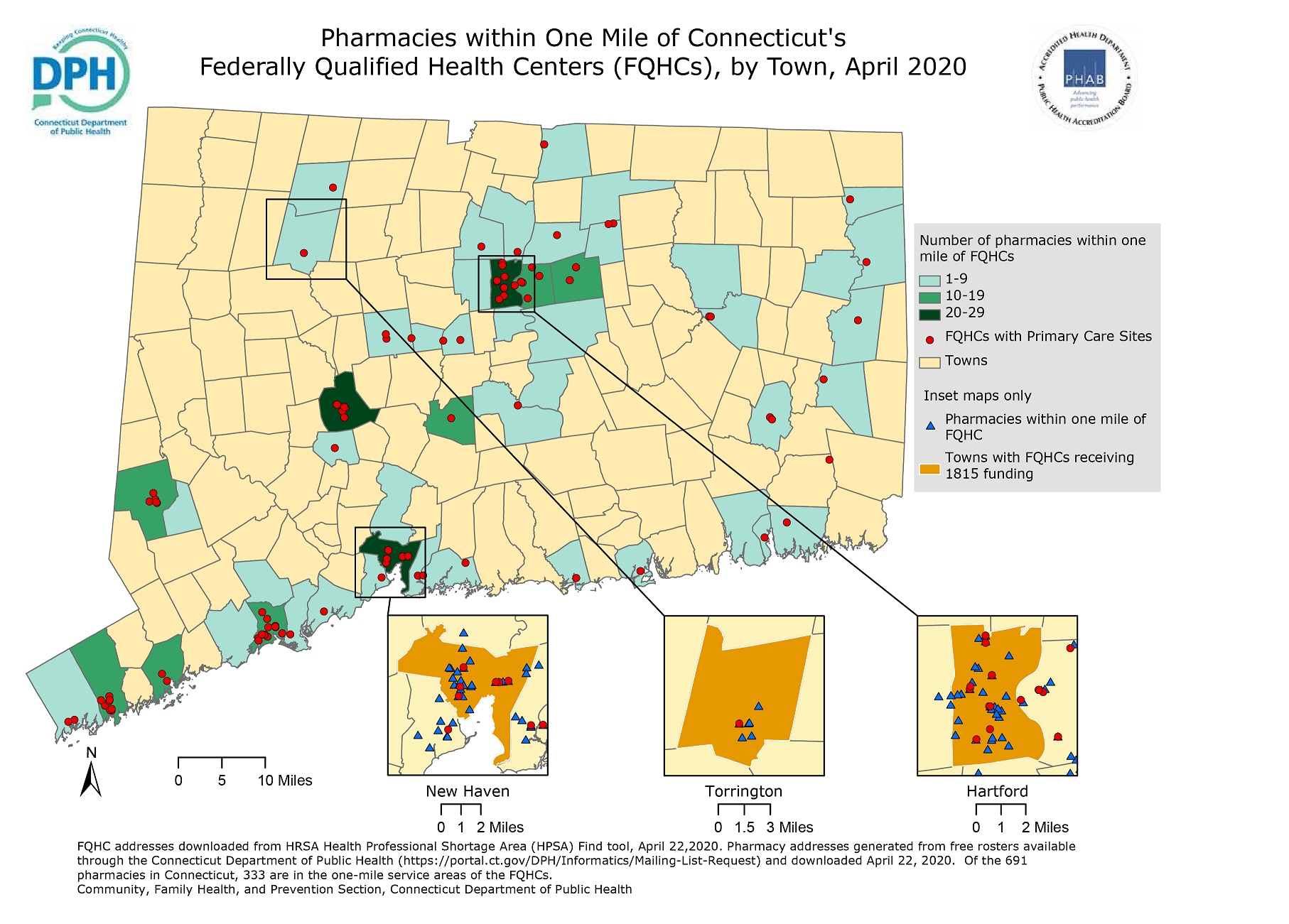
This map helps readers understand the number of pharmacies in close proximity to Federally Qualified Health Center (FQHC) primary care sites. Partnering with these pharmacies may enhance the management of chronic conditions by offering services such as medication therapy management and diabetes self-management education.
ArcGIS Pro 2.5.2
FQHC addresses were downloaded from the Health Resources and Services Administration (HRSA) Health Professional Shortage Area (HPSA) Find Tool on April 22, 2020. Pharmacy addresses were generated from free rosters available through the Connecticut Department of Public Health (https://portal.ct.gov/DPH/Informatics/Mailing-List-Request) and downloaded on April 22, 2020. The 2018 road network dataset used was created by the Children’s Environmental Health Initiative (CEHI) from the publicly available TIGER/Line roads for the Connecticut area. Pharmacy addresses were geocoded using a geocoder built by CEHI and is based on 2018 TIGER/Line road data published by the US Census.
A network analysis was conducted to calculate the one-mile service areas of Connecticut FQHC primary care sites. The one-mile service areas were based on drive distance. Pharmacy locations were geocoded and those within the one-mile service areas were selected and displayed.
This map will be used by the Connecticut Department of Public Health 1815 program and the FQHCs receiving funding through this program to determine potential partners in Medication Therapy Management (MTM). The FQHCs may develop collaborative practice agreements with the pharmacists in these nearby pharmacies to conduct MTM. These pharmacies may be contacted to determine the facilitators and barriers to offering MTM. This information may inform the development of policies and systems that promote the use of MTM.
Stephanie Poulin, Epidemiologist, Connecticut Department of Public Health
Stephanie.Poulin@ct.gov
(860) 509-8252
Poulin, Stephanie M., MPH, Connecticut Department of Public Health. Accessed from the Centers for Disease Control and Prevention's Chronic Disease Map Gallery.

