Key points
Map

Data sources
ArcGIS Pro
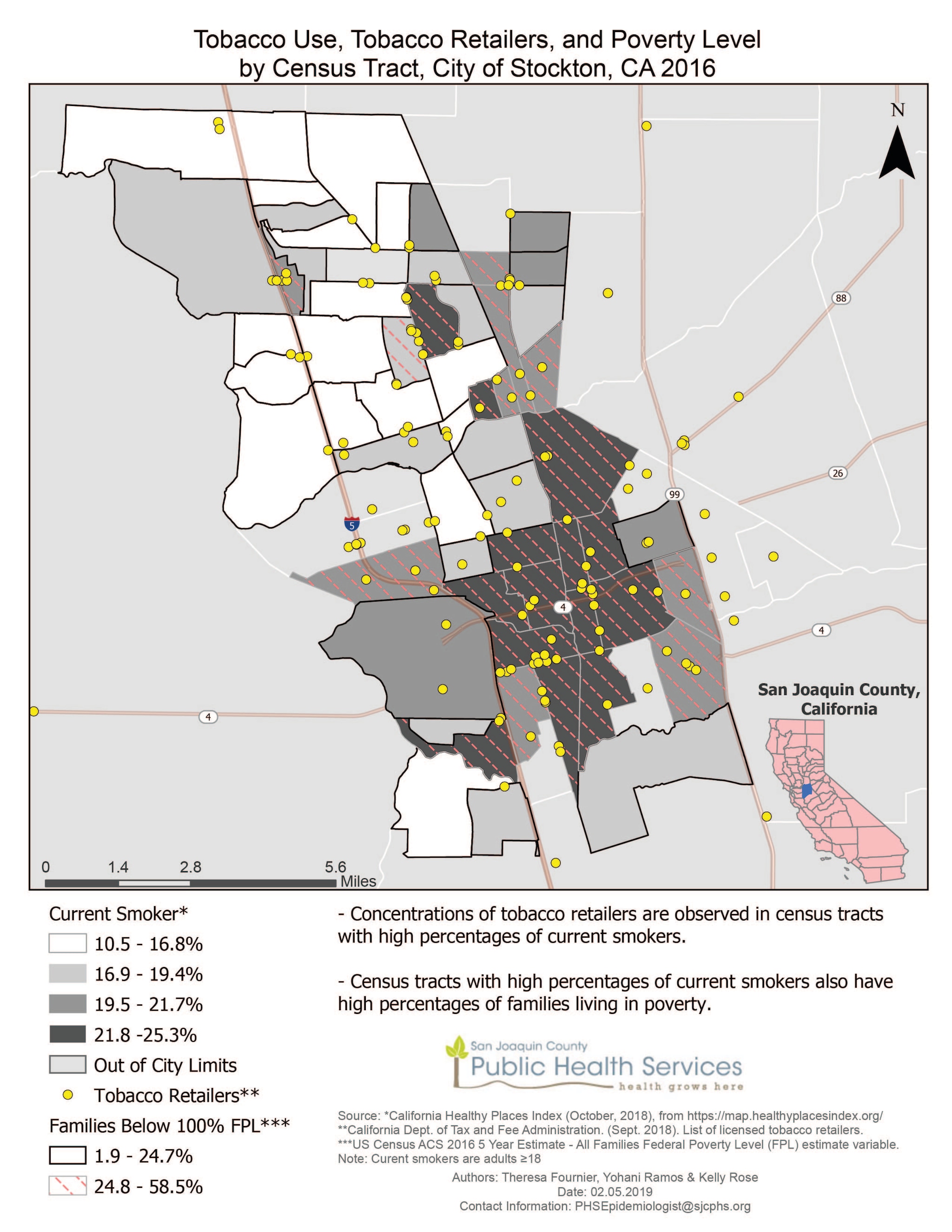
Source: California Healthy Places Index (October, 2018), from https://map.healthyplacesindex.org/.
*California Dept. of Tax and Fee Administration. (Sept. 2018). List of licensed tobacco retailers.
**US Census ACS 2016 5 Year Estimates – All Families Federal Poverty Level (FPL) estimate variable.
Retrieved current smoker data from the California Healthy Places Index. Tobacco retailer locations were retrieved from the California Board of Equalization. For poverty data, we used U.S. Census data, and classified the data using the natural breaks method with two classes.
Theresa Fournier, Epidemiologist, San Joaquin County Public Health Services
209-468-3881
Tfournier@sjcphs.org
Fournier, T.; Ramos, Y.; Rose, K., San Joaquin County Public Health Services (SJCPHS), Epidemiology. Accessed from the Centers for Disease Control and Prevention's Chronic Disease Map Gallery.
