Key points
Data sources
ESRI ArcGIS Pro
CA Department of Tax & Fee Administration 2018; US Census Bureau ACS 2010-2014; CA Department of Public Health Nutrition Education & Obesity Prevention Branch 2016; CDC BRFSS 2014
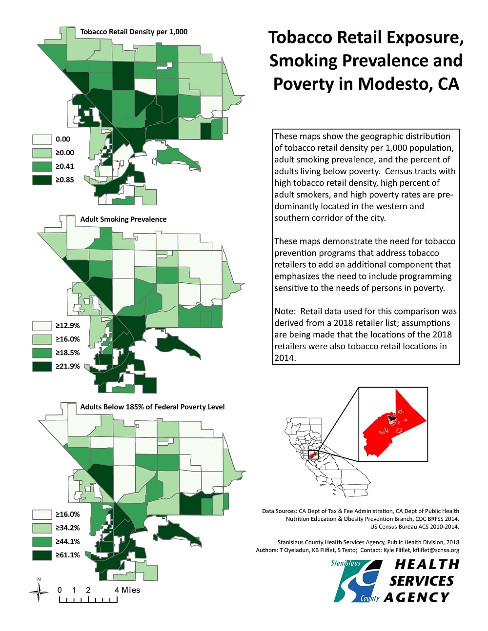
Three maps were created to assess smoking prevalence in relation to tobacco retail density and poverty level. Data from the California Department of Tax & Fee Administration, CDC BRFSS, and US Census Bureau were utilized to map out tobacco retailers, smoking prevalence, and poverty level. CA Department of Public Health Nutrition Education Obesity Prevention data was used to lay out census tracts within Modesto. Retailer density was calculated using the total population and the total number of tobacco retailers within census designated tracts.
Setar Testo, Program Coordinator, Stanislaus County Health Service Agency
209-525-4810
stesto@schsa.org
Oyeladun, Titus, Stanislaus County Health Service Agency; Fliflet, Kyle, Stanislaus County Health Service Agency; Testo, Setar, Stanislaus County Health Service Agency. Accessed from the Centers for Disease Control and Prevention's Chronic Disease Map Gallery.

