Key points
Data sources
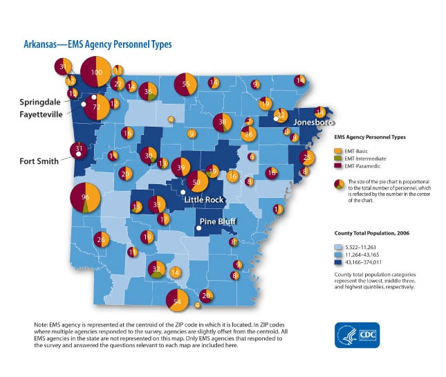
The purpose of this map was to display approximate locations of Emergency Medical Services (EMS) agencies and total number of personnel employed at each agency in order to show EMS capacity by location. This map was provided to state EMS directors and other EMS partners to help inform them on EMS capacity to respond to acute cardiovascular events.
ArcGIS 9.2
Data are from EMS Survey conducted in 2008.
Choropleth map with pie charts placed at zip code centroid.
Sophia Greer, Epidemiologist, CDC
(770) 488-5467
fgz3@cdc.gov
Arkansas EMS Agency Personnel Types Sophia Greer CDC, Ishmael Williams CDC. Accessed from the Centers for Disease Control and Prevention's Chronic Disease Map Gallery.

