Module 2: Infrastructure to Accommodate Pedestrians and Bicyclists

At a glance

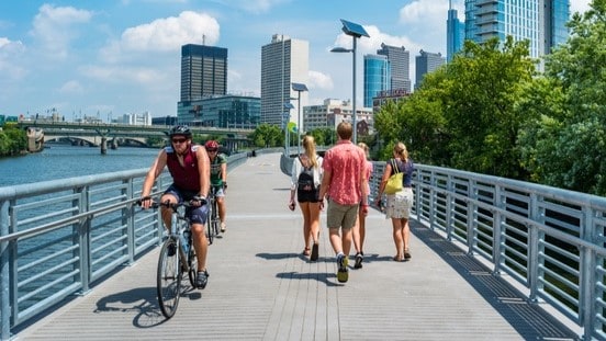
This module helps users assess the plans, policies, environments, and resources for infrastructure to accommodate pedestrians and bicyclists. This may include paved and unpaved paths, bicycle lanes, wide paved shoulders, bicycle routes, and sidewalks.

People walking and biking across a bridge.

About this module

Who should be involved: Experts with knowledge of the community's pedestrian and bicycle infrastructure plans, policies, and resources. This includes experts in:

  • Planning
  • Transportation
  • Public works

Time to complete: It will take approximately 2 hours and 30 minutes (150 minutes) to complete all sections of Module 2.

Module 2 sections

Module 2 has three sections:

  • Section A—Infrastructure to Accommodate Pedestrians and Bicyclists
  • Section B—Infrastructure to Accommodate Pedestrians
  • Section C—Infrastructure to Accommodate Bicyclists

If you are interested in improving infrastructure to accommodate pedestrians and bicyclists, you should complete all sections.

If you are mainly interested in improving infrastructure to accommodate pedestrians or want to enhance this portion of your plan, complete sections A and B.

If you are mainly interested in improving infrastructure to accommodate bicyclists or want to enhance this portion of your plan, complete sections A and C.

Terms and definitions

Arterial roads: High-capacity roads that primarily deliver traffic from collector roads to freeways/expressways and between urban centers.

Bicycle boulevard: A low-stress shared roadway bicycle facility designed to offer priority for bicyclists when they share a roadway with motor vehicle traffic.

Bicycle facility: A general transportation term to describe improvements and provisions to accommodate or encourage bicycling. This may include parking and storage facilities and shared roadways not specifically designated for bicycle use.

Bicycle lane: A portion of the roadway designated for the preferential or exclusive use of bicyclists. The bicycle lane is indicated by striping, signage, pavement markings, or physical barriers. Bicycle lanes may include sharrows, buffered bicycle lanes, conventional bicycle lanes, and protected bicycle lanes.

Buffered bicycle lane: On-street bicycle lane separated from the motor vehicle travel lane and/or parking lane through a designated buffer space.

Buffer distance: The amount of space between the bicycle lane and the adjacent motor vehicle travel lane or parking lane. Buffer distance is usually indicated by two solid white lines and may have diagonal hatching or chevron markings.

Collector roads: Roads that gather traffic from local roads and deliver traffic to arterial roads.

Complete Streets: Streets that make it easy to cross the street, drive a car, bicycle, or walk along the street. Streets designed to allow safe access for all users, including public transportation riders, bicyclists, pedestrians, transit users, and motorists.

Comprehensive plan: An official statement adopted by a local governing body. This statement sets forth (in words, maps, illustrations, and/or tables) goals, policies, and guidelines intended to direct the present and future physical, social, and economic development that occurs within its planning jurisdiction and that includes a unified physical design for the public and private development of land.

Conventional bike lane: A space specifically for bicyclists indicated through the use of pavement markings and signage. It is usually adjacent to motor vehicle travel lanes and flows in the same direction as motor vehicle traffic.

Health disparities: Particular types of health differences closely linked with social, economic, and/or environmental disadvantage. Health disparities negatively affect groups of people who have systematically experienced greater obstacles to health and/or clean environments based on their:

  • Racial or ethnic group.
  • Religion.
  • Socioeconomic status.
  • Gender.
  • Age.
  • Mental health.
  • Cognitive, sensory, or physical disability.
  • Sexual orientation or gender identity.
  • Geographic location.
  • Other characteristics historically linked to discrimination or exclusion.

Health equity: When everyone has the opportunity to be as healthy as possible.

Local ordinances: Policies passed by local governing authorities, such as a city council or board of commissioners. Local ordinances include—but are not limited to—zoning regulations, subdivision ordinances, and street design guidelines.

Local roads: Streets that provide local access. These may include non-arterial roads.

Low-speed shared streets: A street environment where pedestrian activity is high and vehicle volumes are low or discouraged. Low-speed shared streets are usually local-access, narrow streets without curbs and sidewalks. Vehicles are slowed by placing trees, planters, parking areas, and other obstacles in the street. Motorists are encouraged to travel at very slow speeds.

Mode share: The percentage of travelers who take trips by:

  • Bicycle.
  • Private vehicle.
  • Public transportation.
  • Foot.

Performance measures: Quantitative and qualitative metrics used to evaluate transportation projects and/or the transportation system.

Pedestrian facility: A general transportation term to describe infrastructure and support equipment that accommodates pedestrians, such as:

  • Sidewalks.
  • Curb ramps.
  • Shared-use paths.
  • Crosswalks.
  • Signals.
  • Signs.

Protected bicycle lanes: On-street bicycle lane separated from the motor vehicle travel lane and/or parking lane through a physical barrier, such as curbs, planters, or posts.

Shared lane markings (sharrows): A painted marking of a bicycle on the pavement to help convey to motorists and bicyclists that they must share the road on which they are operating.

Shared-use paths: Transporation or recreation paths that include paved or unpaved accommodations for pedestrians and bicyclists. Paved paths include things like greenways, while unpaved paths include things like trails.

Traffic calming: Design measures to improve safety for pedestrians, bicyclists, and transit users by slowing motor vehicle traffic (for example, speed humps or landscaped islands in the middle of intersections).

Wide paved shoulders: Ridable surface 4 feet or wider, with a minimum clear path of 4 feet between rumble strips.