LiDAR Information at SME
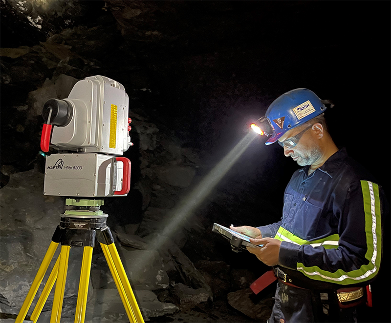
3D LiDAR scanning can be used to characterize variations in the shape of the mine opening and relate that change to unstable ground conditions. NIOSH researchers have utilized this technology to determine mine geometries such as, pillar shape, pillar heights and widths, entry heights and widths, benching heights, and dip angles within the mining horizon.
This technology has also allowed for the detection of minimal changes to the roof, ribs, and floors over time. Changes that were captured using 3D LiDAR scanning include roof falls, cutter roof, roof sag, pillar sloughing, and floor heave. Geologic anomalies such as joints and karst features can be accurately mapped using 3D LiDAR scanning and exact orientations and quantities of these features can be determined.
This technology has proven to be useful for performing a wide variety of assessments all of which have the potential to improve the safety conditions for the underground mine worker.
This work is being addressed in the current NIOSH project: Methods to Reduce Potential for Massive Ground Collapses in Underground Stone Mines.
Additional Resources
Evaluation of Stress-control Layout at the Subtropolis Mine, Petersburg, Ohio
LiDAR mapping of ground damage in a heading re-orientation case study
NIOSH Mining Program's S-Pillar software